OpenStreetMap community

We have bike routes all over, and they are signed with something as shown. But most of these will have a bike lane or sharrows along with the Bike Route signs. However, I ran into one road that doesn't, it's just signed. What's the best way to tag these roads? I don't want to cause confusion, but these unpainted (but signed) roads do actually lead to/from better cycling infrastructure, so they should be known. UPDATE: Thanks for all the input, guys. Having looked into this further, I'm comfortable using the designated tag, at least for this specific road. My municipality is a bit bipolar with their application of these signs. Most are signed as bike routes with toad markings, but a few are signed only. Because these "bike routes" connect to more significant cycling infrastructure, I think its more than valid to tag them as “designated” as opposed to "yes" (which would be pretty much every road). To add even more confusion to the situation, the official Cycling infrastructure map for my municipality seems to not include several areas that have both bike route signs and road markings, so i will ask them if the data is just lagging or if it needs to be updated. So, unless there's a critical reason why the "designated" tag shouldn't be used in this context, I will leave it at that.
> Of the 1971 voters in this election, 740 cast ballots. Craig Allan, Maurizio Napolitano, Laura Mugeha, and Héctor Ochoa Ortiz are the winners after counting the ballots using Scottish STV.
I'm on Street Complete and I'm trying to differentiate between Concrete, Concrete slabs, and concrete lanes. There's a walkway that's just a normal concrete walkway, I didn't know there were so many designations for this.
I know that is at first a geo database but has anyone build a better web ui where i can plan routes with public transport just like on google maps
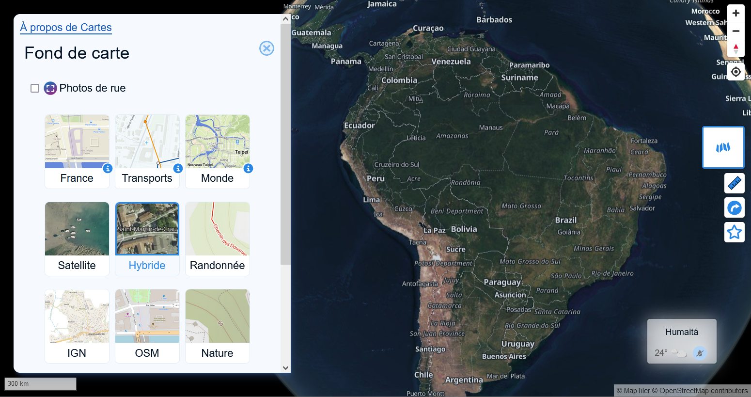
**How do I make an office appear on OpenCycleMap?** The local representation of the German Cyclists' Association has an [entry on OpenStreetMap](https://www.openstreetmap.org/node/1199240513) and has tools and an air pump for cyclists on site. We would like the association to appear on OpenCycleMap as well. For this purpose, both service:bicycle:pump=yes and service:bicycle:repair=yes have been set for the node. It's been more than a week since the according changes were made - unfortunately I still [can't see the location in OpenCycleMap](https://www.opencyclemap.org/?zoom=18&lat=51.34375&lon=12.36887&layers=B0000). Any ideas what to do? [\#OpenCycleMap](https://friendica.xyz/search?tag=OpenCycleMap) [#OpenStreetMap](https://friendica.xyz/search?tag=OpenStreetMap)
For our parkour group, we have a list of spots with custom pictures of the spots, embedded right into google maps, so you don’t have to click on any other website. This is quite cool and convenient. Is there any way to move that list (manually is ok) to OSM? E.g. in a city guides functionality, which I have some memory of, but don’t know where it comes from.

When I first tried OsmAnd a few years ago it was overwhelming, there is so much to customize. I tried it again recently and it really impresses me. My OsmAnd ski profile shows me slope for avalanche risk and 3D relief so I don't need Fatmap, plus OsmAnd let's you download 7days of weather. OsmAnd doing routing on hiking trails replaces my need for Gaia. Really impressive work by the OsmAnd team.
[@openstreetmap@lemmy.ml](https://lemmy.ml/c/openstreetmap) made my first [#opendata](https://social.edu.nl/tags/opendata) contributions to [@openstreetmap@en.osm.town](https://en.osm.town/@openstreetmap) yesterday. Pull request dopamine AND alternative reality game dopamine? Sign me up ([#foss](https://social.edu.nl/tags/foss) [@organicmaps](https://fosstodon.org/@organicmaps) is terrific both at navigation and mapping)

I am using a fresh osmand install, and now I have this widget on the right showing the wrong altitude. Always about 50m too high. The bottom widget shows the correct altitude however, that is kinda weird. I have updated the app now, but same thing. Using f-droid latest version, but this happened also with the one I had before (4.85). I am also using brouter plugin for navigation, maybe the correct altitude comes from there idk. The wrong one is also displayed when in the default profile with no brouter involved. Anybody else seeing this phenomenon? Oh and the "centre map" altitude doesn't seem to be working at all, but I don't need that anyway.

I've been playing around with Google Maps lately to create custom maps. I don't like google but have no experience with any other apps and have never tried mapping of any sort before. I'm trying to create a map layer(s) that has historic sites, stone circles, woodland, cemeteries, UNESCO sites etc. So if I'm traveling I can stop and see them. I've created my own Google Map using lists of sites from Wikipedia. This has gone ok but leads to a lot of data cleansing and the functionality isn't great. I've seen this website but it isn't as complete as the Wikipedia text lists ive imported: https://www.hmdb.org/ I'm completely new to this and have no experience. Are there any good resources out there for me to use or contribute to? I'd like to de-google as much as possible. P.S. do I need to enable developer mode or root my phone to install open street map now? Thanks!
[@openstreetmap](https://lemmy.ml/c/openstreetmap) A while ago I've seen a before-after screenshot command line tool for osm mentioned somewhere but I cannot find it anymore. I believe it was written in python. Does anyone know the name of the tool in question? [\#OSM](https://breta.moe/tags/OSM) [#OpenStreetMap](https://breta.moe/tags/OpenStreetMap) Edit: Thanks to [@richlv](https://mastodon.social/@richlv) , this is it: [https://github.com/amandasaurus/osm-mapping-party-before-after](https://github.com/amandasaurus/osm-mapping-party-before-after)

cross-posted from: https://feddit.org/post/2989211 > [Mastodon Toot.](https://fosstodon.org/@rudo/113161889347653944) > > [Project.](https://rudokemper.github.io/google-maps-places-to-organic-maps/)
When I read about Overture Maps like a year or 2 ago, it seemed to me that basically they were going to create a whole new thing from scratch. Let's be honest, with enough resources, it's easy to see that they could pull off some kind of OpenStreetMap 2.0, where all the issues from OSM are modernised and cleaned up. What's really going on? Are we getting something soon from these people? What's the relationship with them? [On their website](https://overturemaps.org/), they say "coming this fall". Are you excited? Scared? What should I think?
I've encountered some conflicting usages of [Tag:landuse=residential](https://wiki.openstreetmap.org/wiki/Tag:landuse%3Dresidential). Some areas are very specific, and broken down into individual blocks, while some areas cover multiple blocks. Here's an example of both styles adjacent to each other: https://www.openstreetmap.org/way/653823458 https://www.openstreetmap.org/way/652122607 The wiki doesn't really say much on the topic. Does anyone have opinions/rules of thumb on how to tag them exactly? It seems like all adjacent areas not separated by major highways should be joined together? I've encountered some residential areas that are broken down into mapping each block, and literally follow the curb, rounded corners and all. That seems too specific?
I'm looking at [Tag:crossing=marked](https://wiki.openstreetmap.org/wiki/Tag:crossing%3Dmarked), and it's a little vague. It says: > Set a node on the highway where the transition is and add highway=crossing + crossing=marked. > > If the crossing is also mapped as a way, tag it as highway=footway footway=crossing crossing=marked or highway=cycleway cycleway=crossing crossing=marked as appropriate. Doesn't that violate the principle of [One feature, one OSM element](https://wiki.openstreetmap.org/wiki/One_feature,_one_OSM_element)? For example, here's a crossing from where overpass-turbo defaults to showing: https://www.openstreetmap.org/node/7780814396 https://www.openstreetmap.org/way/833493479 You've got a `way` with these tags: ``` crossing=marked crossing:markings=yes footway=crossing highway=footway surface=asphalt ``` And the intersection node with the street it's crossing has these tags: ``` crossing=marked crossing:markings=yes highway=crossing tactile_paving=no ``` Shouldn't that be one or the other? It makes sense to me to represent the crossing as a `way` with all the tags, and leave the intersection untagged. I noticed though that StreetComplete doesn't really like that, and will give you quests to add tags to the intersection node even if the `way` is properly tagged.
Just a super quick question about helping to update the map locations. Between StreetComplete and Organic Maps, which is faster for submitting recommended changes to the OSM team in regards to things like business hours, etc...
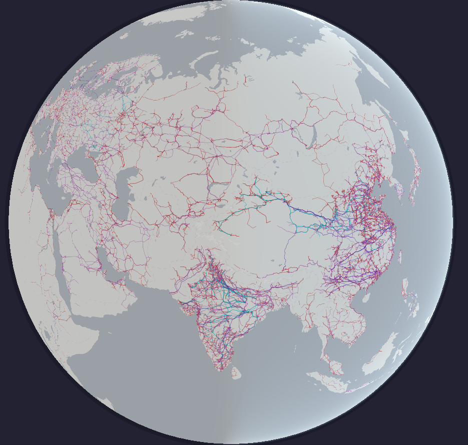
Some really cool transit map generation from OSM data. There's an online demo you can play with [here](https://loom.cs.uni-freiburg.de/global).
  One shows only a few shops, [often the ones that pay the most](https://support.google.com/google-ads/answer/7040605), the other shows the true number of different places in the area.
@osmand why are you so slow? this is a brand new samsung galaxy s24+ [@openstreetmap](https://lemmy.ml/c/openstreetmap)
[@openstreetmap](https://lemmy.ml/c/openstreetmap) Is there any documentation on mapping individual small plants like flowers or cacti? I'd like to start mapping botanical gardens but cannot find any information on this.

Das Atomium in [#Brüssel](https://troet.cafe/tags/Br%C3%BCssel), gerendert in [#cgeo](https://troet.cafe/tags/cgeo) auf der 3D [#OpenStreetMap](https://troet.cafe/tags/OpenStreetMap) [#Freizeitkarte](https://troet.cafe/tags/Freizeitkarte) sieht lustig aus. [@openstreetmap](https://lemmy.ml/c/openstreetmap) [@geocaching\_de](https://a.gup.pe/u/geocaching_de)
 xkcd.com
cross-posted from: https://discuss.tchncs.de/post/21076796 > xkcd #2977: Three Kinds of Research > > alt text: > > > The secret fourth kind is 'we applied a standard theory to their map of every tree and got some suspicious results.' > > https://explainxkcd.com/2977/
Hi is there some project, instructions or some github repo for converting 360° video and GPX file to something like street view? I would like to map this way local cycling routes.

I have recently got into mapping traffic signs and speed limits where I can, but I realised I don't know what to do when mapping differing speed limit signs that are offset from each other. It's a transition from a 50km/h zone to a 60km/h zone but the signs are offset by 65m, making a sort of "no-mans land" in-between. I plan to map it with the in-between zone tagged with separate `maxspeed:forward` and `maxspeed:backward` tags. I assume it should be done this way because as a driver on the ground I would follow the speed limit signs on my side of the road as I passed them, having no knowledge of the reverse sign. I guess I'm wondering if this is a logical way to map this?
I recently got a Pixel and installed GrapheneOS on it. I would like to add some places to the map. Is there anything I need to know regarding preserving my privacy while contributing? Thank you for any advice.
It's a key feature of Google maps that I don't have a great replacement for. I assume moderating the reviews would be a significant challenge for the project.
 social.lol
>[**Henry**@hl@social.lol](https://mastodon.social/@hl@social.lol "hl@social.lol") > > Glad to see the great job [@openstreetmap](https://mastodon.social/@openstreetmap@en.osm.town "@openstreetmap@en.osm.town") and [@organicmaps](https://mastodon.social/@organicmaps@fosstodon.org "@organicmaps@fosstodon.org") are doing. For cycling to the zoo's main entrance, where I can buy entry, they suggest a sensible route. [#Google](https://mastodon.social/tags/Google) maps seems to suggest I go through the zoo, possibly via the tiger cage. > >https://social.lol/@hl/113047359789803891 - - - >[**Dawid Rejowski**@didek@101010.pl](https://mastodon.social/@didek@101010.pl) > >[@hl](https://mastodon.social/@hl@social.lol "@hl@social.lol") [@openstreetmap](https://mastodon.social/@openstreetmap@en.osm.town "@openstreetmap@en.osm.town") [@organicmaps](https://mastodon.social/@organicmaps@fosstodon.org "@organicmaps@fosstodon.org") > >Also somehow ZOO looks more like a ZOO. > >Here I needed a while to understand what is that place. Only after reading the labels I understood it is the center of Warsaw, a place that should be one of the most recognizable places in Poland.\ >Compared to OragnicMaps, with rich colors, colorful Metro icons, building shapes and rails, Google Maps looks very blended. > >https://101010.pl/@didek/113050389244877936
I've got a patio for a restaurant tagged as [leisure=outdoor_seating](https://wiki.openstreetmap.org/wiki/Tag:leisure%3Doutdoor_seating). That page says you can add `operator=*` as a string, but I'm wondering if I can add a Relation between the patio and the restaurant. This is really for semantic reasons, because if the restaurant changes its name or gets a new owner, it would be nice if the patio didn't then have out-of-date information. I don't see a [Relation type](https://wiki.openstreetmap.org/wiki/Key:type) that's relevant. I don't want to just start doing my own thing, so does anyone know of a way to use a Relation here, and if not, is that something that can be proposed? Thanks for all of the responses on my other questions, btw. This community has been very helpful.
I'm taking a look at traffic circles like this: https://www.openstreetmap.org/edit#map=19/33.790043/-118.142392 The main traffic circle has been split up into 8 different segments, so that individual segments can have Relations added to them, such as the "Long Beach Transit 174" bus route. I'm new to mapping, so I don't really know what to expect, but it seems odd to split it up like that. It ends up adding noise to StreetComplete, in that I can't just say "yep, this traffic circle is asphalt", I have to go to a bunch of tiny segments and mark each one of them as asphalt. I've also seen this for items generated from Lyft data, where a single road gets split into tiny segments so that one part can be marked as "no u-turn" or "no left turn". StreetComplete wants me to mark each tiny segment individually.